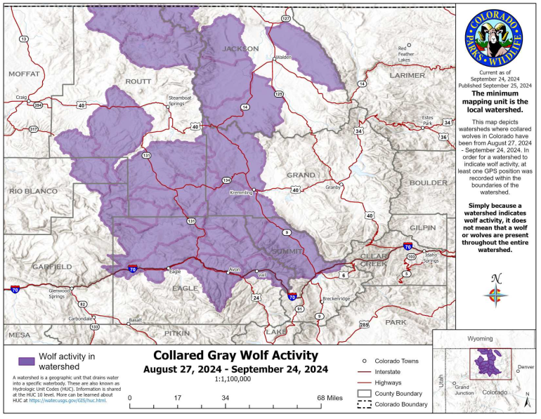
Collared gray wolf activity recorded by CPW from August 27 – September 24, 2024
Above is updated map just published by Colorado Parks and Wildlife (CPW) showing where collared wolves have been in the past month.
Notable Updates
- Highlighted watersheds can be disconnected. If wolves are moving quickly enough, a GPS point may not be taken in every watershed they travel through. GPS points are currently taken every 4 hours.
- CPW captured and relocated wolves from the Copper Creek pack with technical support from federal partners. This month’s map does not include collar data for the Copper Creek pack.
- CPW continues to monitor eight wolves in the wild
- Wolves remain north of I-70 even though the watershed areas highlighted are slightly south of the I-70 highway line.
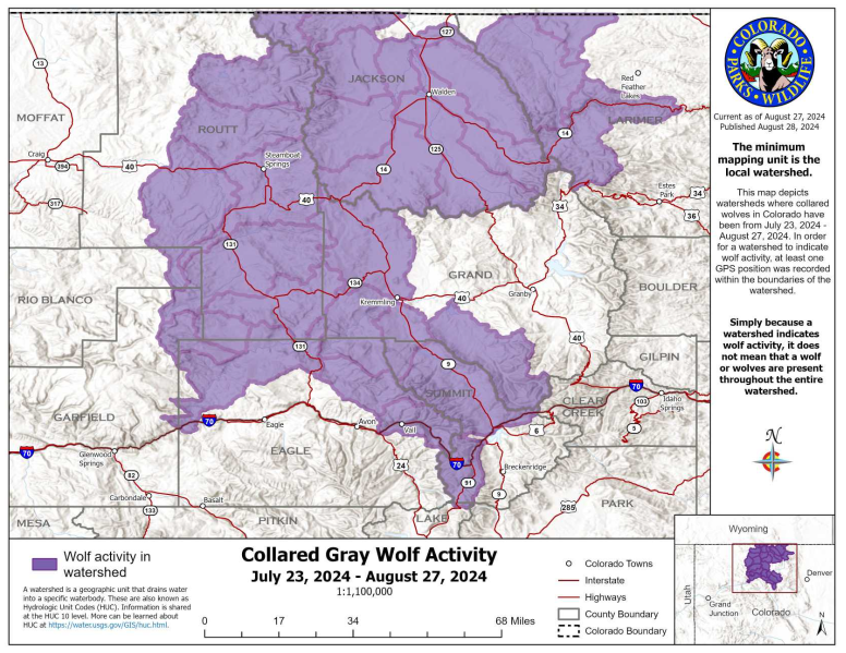
For comparison, below is the map for the previous month.
Collard gray wolf activity recorded by CPW from July 23 – August 27, 2024
 Eastmans' Official Blog | Mule Deer, Antelope, Elk Hunting and Bowhunting Magazine | Eastmans' Hunting Journals
